Halo IDs
One QR identity for every lot.
Unique, scannable identities per lot and unit. One scan opens a branded Halo Page with the story you choose to share.
Haloglide Orbit
Capture what happens, prove where it came from and hand regulators and buyers a verifiable record on demand. Powerful traceability, EUDR automation and provenance proof, priced for small and medium businesses. From $399 USD / month.
From $399/mo
Transparent SMB pricing
Quick set up
Start tracking in days, not months
Deforestation checks
Automatic, with the statement drafted for you
31 languages
Buyer proof pages, revocable anytime
The platform in numbers
Live figures from Haloglide Orbit. Every task, stage, data element and automation is ready to switch on for your value chain.
1,500+
Ready to run tasks
Standard operating steps you switch on, not process design before you start.
30+
Value chains modelled
Coffee, cocoa, timber and more, start from a working model of your commodity.
330+
Value chain stages
Every stage from farm to buyer already mapped, configured not built from scratch.
1,800+
Standard data elements
Shared field definitions, so the same fact means the same thing to everyone.
7
Standards out of the box
EUDR and major schemes pre built, so audits check what you already record.
30+
Satellite and partner data feeds
Deforestation, land and risk data pulled in automatically.
190+
Automations shipped
Routine checks and follow on steps run themselves.
31
Languages
Suppliers and field teams work in their own language.
Why it matters
Most SMBs are stuck between spreadsheets and systems that were built for global enterprises. Orbit gives you the same standards-based traceability, GS1 Digital Link, EPCIS 2.0 and tamper-evident records, in a package that fits your budget and your team.
Prove origin, automate EUDR, narrow recalls, verify certificates and share exactly the right evidence with buyers and regulators. All from one place.
Core capabilities
Halo IDs
Unique, scannable identities per lot and unit. One scan opens a branded Halo Page with the story you choose to share.
Flight Recorder
Receive, process, pack, certify, dispatch. Every critical tracking event is timestamped, geolocated and evidenced.
Commercial lot management
Assemble Commercial Lots from Product Lots down to Farm Lot and Plot. KDEs and evidence are inherited automatically, with a review step before you publish.
Mission Control
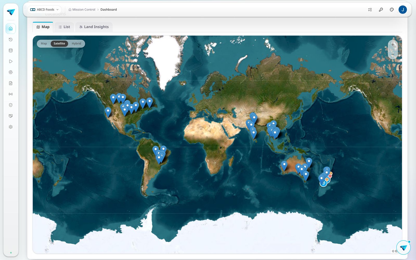
A live map of every location and lot. Zoom into farm boundaries, inspect EUDR status and follow the value chain end to end.
Proof Pack
Certificates, photos, invoices and lab results attached to the right lot. Mark what stays private and what buyers can see.
Task automations
Templated tasks for every step. Recording an event auto creates the flight recorder entry and updates linked evidence.
The workflow
Nothing has to be reconciled at the end because everything was captured in place.
Capture
Register products, locations and lots. Attach KMLs and Orbit auto records the boundary evidence task.
Verify
Run EUDR checks and Land Insights per plot. Verified farms are stamped across every map and share.
Assemble
Build Commercial Lots from Product Lots. Lineage, KDEs and evidence are inherited automatically.
Prove
Generate a draft due diligence statement or publish a Provenance Statement. Buyers and regulators see the same verified record.
EUDR and certification
Upload a KML and Orbit runs WHISP and Global Forest Watch checks per plot, then stamps the farm verified. Turn a Commercial Lot into a Draft Due Diligence Statement in one click, with lineage, plots and risk reasoning drafted for you. TRACES Ready.
ProTerra
Data collection tools, out of the box
Verra
Structured capture, ready to submit
Certificate detail
Number, body, validity, version, scope
Publisher libraries
ProTerra Foundation content, live via Halo Connect
Land Insights
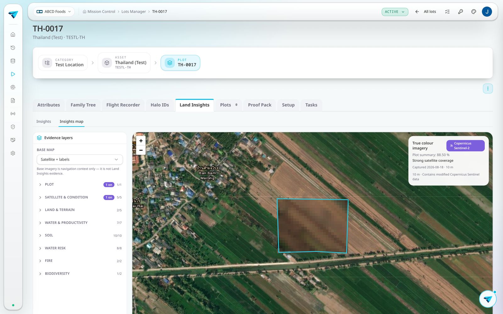
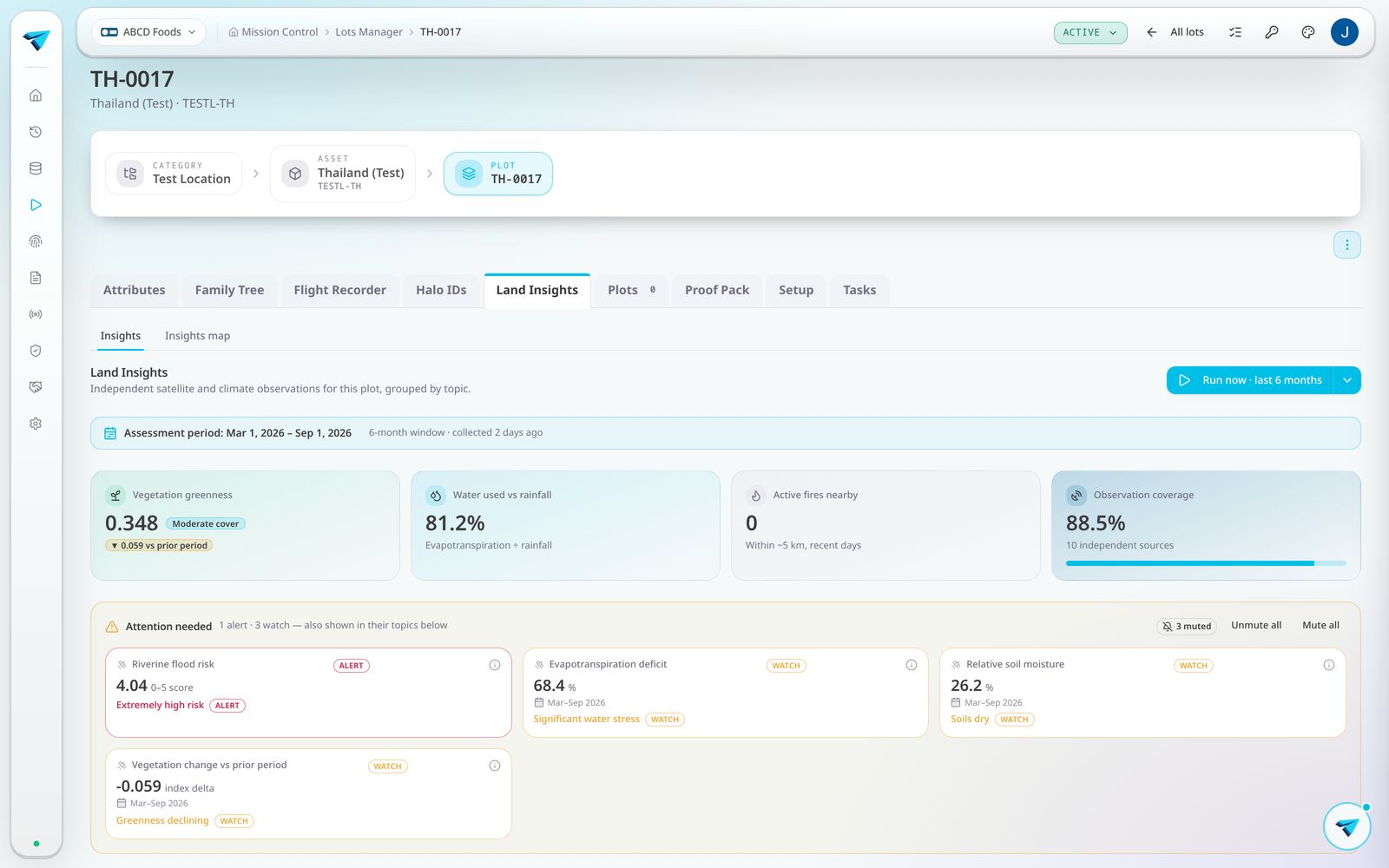
Run Land Insights on any plot or lot and Orbit assembles a sourced, timestamped picture of the land. No consultants, no PDF hunts, no guesswork.
9
Live data sources. Copernicus Sentinel-2, CLMS, Copernicus DEM, NASA POWER, FAO WaPOR, NASA FIRMS, GBIF, WRI Aqueduct and ISRIC SoilGrids
~150
Measured attributes. Vegetation, canopy moisture, evapotranspiration, rainfall, soil, biomass, biodiversity, water risk and more
2080
Climate scenario overlays. Optimistic to pessimistic projections, modelled decades ahead
Advanced mapping overlays
True colour imagery, vegetation indices, water signal, soil depth bands and deforestation risk, stacked on your plot boundaries with opacity control and inspection.
Biodiversity and water
Species occurrence records and IUCN status around your plots, plus WRI Aqueduct water stress baselines and forward scenarios.
Provenance and IP protection
Turn recorded events into buyer-ready Provenance Statements in three modes: a warm Marketing Overview, a complete factual chain and a technical Product Information Form.
Live Link controls what each channel sees. Choose the widgets, attributes and fields that flow to the public Halo Page, the asset detail screen or a marketing URL. Recipes, formulations and commercially sensitive data stay private unless you explicitly release them.
Every share becomes a read-only proof page in 31 languages. Refresh or revoke it anytime.
Pricing
A complete traceability foundation for small and medium teams. No hidden per-seat fees for core tracking. Upgrade to the full Haloglide platform as your operation grows.
Halo ID & QR labels
Included
Flight Recorder
Included
EUDR Toolkit
Included
Provenance Statements
Included
See how Haloglide Orbit gives your team a single source of truth for every product, batch and event.